Even though the area is very wild in appereance, we have seen no wildlife at all. This situation is probably caused by poaching. A decade ago, when I asked a local, where wild animals had gone, he laughed and said: "We ate them all!"
This is a great contrast to my experience from romanian part of the Eastern Carpathian Mountains a week after this trip.
Picture story about my recent trip to Ucraine, more exactly to Transcarpathia which once was a part of former Czechoslovakia.
In this story you can observe our trip in great detail, almost in minute-by-minute steps.
For one thing this trip is unique, I was lucky enough to take images of our every camp. We camped for 8 nights, so you will visit in all 8 camps. I think that I never succeded to take images of all camps on such a long adventure. Great deal to this success goes to great photographic potential in places where we camped, and perhaps to my determination to undertake this task. My will pushed me out of warm sleeping bag at each sunrise or even before, not an easy thing in July at the latitude N 48°.
The pictures are quite a good stuff, I think. The greatest part of this goes to changeable weather we experienced there. Sun alternated with rains, and storms. This kind of weather is likely to have greater photographic potential then flawlessly blue skies without a single cloud.
Day the 1st
The first thing wa had to do after arrival at it's capital- Uzghorod was changing money.

After changing 50 euros I instantly felt like a millionaire.

The second most important thing was getting into the mountains. We took a bus. With a detour via Vinogradovo it took us about eight hours to get to Yasinya on the east of Transcarpathia.
Our team aboard of local autobus; from left to right: Jura, Robin and Kimi, (Otto is behind the lens).
Our team aboard of local autobus; from left to right: Jura, Robin and Kimi, (Otto is behind the lens).

Nothing has changed, when speaking about condition of bus terminals, in Transcarpathia. And buses are still cheapest way to go across the country.

Timeless bus terminal in Mukatschevo, looks exactly the same as in 1993, when I was there for the first time.

Gothic church, picture taken through bus window somewhere in Vinogradovo area.

Bussy taking pictures through bus windows. Results are not perfect, but worth of the effort. Sometimes they have bizzare look.

Celebrating arrival in Yasinya. Cheers!

Group photo in a pub in Yasinia. Sun is shinning for us.

Out on the streets we cross a bridge.

And meet old style mean of transportation-a horse pulled cart. This way is still alive in the Carpathian Mountains.

Church of Saint Peter and Paul in Yasiniya. The hutsul type of wooden church. I have a picture of it, published in 1924. Then there were no trees around the church.

Finally we got out of the village and set up a camp on a pasture above the valley. Having no tripod along with me, I put my camera on a camera bag and set it on self-timer for 5-second exposure.

Day the 2nd
Cloudy skies in the morning announcing that it is going to rain, a normal weather in Transcarpathia.

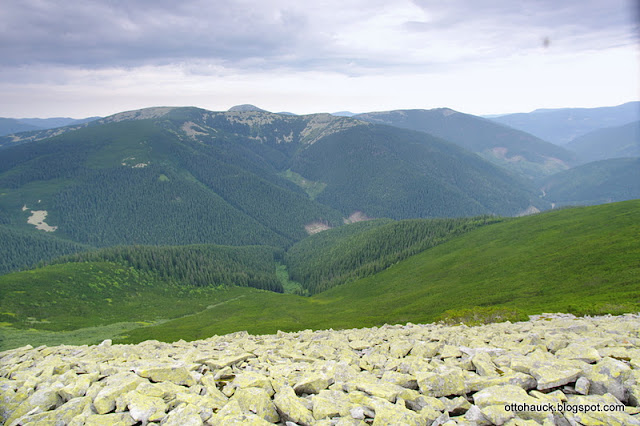
The crest of the Carpathian mountains under cloud layer. Typical landscape in the Carpathians.
Polonina Swidowetz is peering at us from behind a foreground ridge.

The cross: holy edifice, native to the Carpathians.

First look on the Gorgany Mountains crest.
Chomjak Peak on the right.

Hoverla Peak at alt. 2061 m is the tallest mountain in the whole Ucraine.

Another, yet bigger holy edifice. Perhaps they mean the bigger is the thing more holy it is!


Hoverla Peak on the opposite side of the valley.

Approaching crest area with scattered cottages.

Pietrosul and Hoverla, the two giants seen side by side on the opposite side.

Mountain cottages below the crest.

Last moments of sunshine, from now on we will have rain for the remainder of the day.

It started to rain, we are continuing towards the west.


Crossing the fence dividing pastures of one's owner from the another's one. Luckilly, there are no "No Tresspassing" signs yet.


On the crest whe the rain stopped for a while.

Wild forest.

Wild forest road. These dirt roads are my love, they belong to the Carpathians.

New paved road, built in order to bring clients to mountain resort, called Bukovel. It is an ugly artificial intrusion into one of the the last european wild areas.

The new roads looks like a scar leading through wild forest for nothing.

Old forest road overgrown with grass fits better in the mountains.


Climbing in the rain.

Day the 3rd
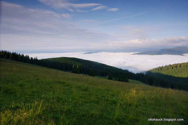
The morning was surpassingly clear. Beneath us were foggy valleys, while mountain crests were bathing in the sun.
Mountains were all around us. In every direction.

It probably was the most spectacular morning in all the week.

Admiring mountainous landscape and hopping the weather will hold good.
 | ||||
| On the crest above Bukovel. |

View toward Stoly saddle, where I visited in 2005; Dobosanka massif in backdrop.

Corno hora and Svidovetz massifs in the distance.

Cows are omnipresent in the Carpathians.


Border stones still demarks boundaries of the 1st Czechoslovak Republic

Sheepfold with stables for cows.

Probably the most photograped border stone on the crest; I have seen it in several publications before setting off on the trip.

A cluster of sheepfold buildings, Corna Kleva massif in backdrop.

Mala and Velka Sywulja, the highest massif in the Gorgany Mountains.

Interior of a sheepfold beneath Ploska Mountain.

Telekia sp. groove. In the past it was named "Bull's eye" in Czech language. In 1950s new name "Kolotočník ozdobný" was invented by czech botanist.

A sheepfold below Ploska peak.

Fording the river.

Fording the river.

Typical valley in the Carpathian Mountains.

Typical houses in the area.

Holy edifices are common in the area.


New house, new holy edifice!

Dust road leading throug the village of Bystrica.

The map of the central part of the Gorgany mountains.

Day the 4th
Morning in our camp outside Bystrica on the banks of the Salatruk River.

Early morning in our camp nearby Bystrica village on the banks of the Salatruk River.

Early morning in our camp nearby Bystrica village on the banks of the Salatruk River.

Early morning in our camp nearby Bystrica village on the banks of the Salatruk River.

Salatrucil brook.

Climbing towards Sywulja massif.

Sywulja massif.

Cows below Sywulja massif.

Polyporus on dying wood, Gorgany mountains.

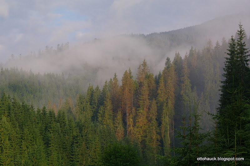
Evergreen mountain spruce forest is most green in July.

Evergreen mountain spruce forest is most green in July.

Summer storm with electric lightnings is coming.


In the rain.

Filling bottle with spring water

Filling bottle with spring water.

Devil's Gorge called "Urva Peklo" in ucrainian language.


At the edge of Devil's Gorge called "Urva Peklo"

Devil's Gorge called "Urva Peklo" in ucrainian language.

Devil's Gorge called "Urva Peklo" in ucrainian language. This was created by avalanche erosion. The avalanche tangue cut deply in the forest is clearly visible.


Day the 5th
Rainy morning below Sywulja.

Rainy morning below Sywulja.

Rainy morning below Sywulja.

Rainy morning below Sywulja.
Here we met with passing group of locals. We learned that they are able to do anything for gettin' some alcohol. One of them walked in the rain throug these marches just to ask whether we had any liquer to give them. We had some plum brandy in our packs, but we refused to give them anything.
They left without a single word. We sighted a relief.

Rainy morning below Sywulja.


Climbing Sywulja in the rain.

Climbing Sywulja in the rain.

Yellowing grasses announce us that the peak of summmer is almost over.


Climbing Velka Sywulja in the rain.

Climbing Velka (Great) Sywulja in the rain. Bravo, Kimi!

Climbing Velka Sywulja in the rain.


Climbing Velka Sywulja in the rain-group photo on the top. this peak is the tallest in the Gorgany Mts. From left to right: Jura. Kimi, Robin and Otto.

After climbing Sywulja in the rain.

Remnants of W.W the 1st; those bunkers seems as if armied forces left them yesterday.

Remnants of W.W the 1st; those bunkers seems as if soldiers left them yesterday.

After climbing Sywulja in the rain.

After climbing Sywulja in the rain.

After climbing Sywulja in the rain.


After climbing Sywulja in the rain.

Scheme, showing marked paths in the area.

Indicators showing directions, they seem to point in the same direction, because the path makes V turn here.

Clubmoss carpet in mountain spruce forest.

Mossy carpet in mountain spruce forest.

Mossy carpet in mountain spruce forest.

Mossy carpet in mountain spruce forest.

At mountain saddle, dividing Sywulja massif from Igrovetz massif.

Indicators at the saddle.

New naturally groving forest.

This area must be clear cut in the past and new forest consist of of birch mainly.

Mossy carpet in mountain spruce forest.

A trail leads through mossy carpet in mountain spruce forest.

Mossy carpet in mountain spruce forest.

Mossy carpet in mountain spruce forest.

Cleared area below Igrovetz massif.

River above Osmoloda village.


River in Osmoloda.

Day the 6th.
The greatest day.
Our tents in Osmoloda.


Our camp in Osmoloda village.

Main street in Osmoloda.

Main street in Osmoloda.

Aluvial plain forest in the Gorgany mountains.

Approaching upper part of the valley below Grofa Peak.

Approaching upper part of the valley below Grofa Peak.

Approaching upper part of the valley below Grofa Peak.

Limax, native to the Carpathians: Coerula carpatica

Mountain vegetation (Cicerbita alpina) at the peak of summer bloom.

Approaching upper part of the valley below Grofa Peak.

Approaching upper part of the valley below Grofa Peak.

Approaching upper part of the valley below Grofa Peak.

Approaching upper part of the valley below Grofa Peak.

Approaching upper part of the valley below Grofa Peak.

Approaching upper part of the valley below Grofa Peak.


Approaching upper part of the valley below Grofa Peak.

Climbing trail below Grofa.

Climbing trail below Grofa.


Mountain fefuge below Grofa.

Mountain meadow below Grofa.

Arrows below Grofa.
Because the rest of the team declined from climbing Grofa peak, I set off alone for the top. The weather was perfect for the summit push. I took me an extra hour of effort to get to the top and back. I do not regret, that hour paid itself by having great views over the surrounding mountains. To save energy I hidden my pack (some 14 kg) in the forest and climbed only with my camera waist bag. If I had not climbed this peak, I certainly would want to climb it on next time visit. This climb would be more expensiv and time consuming. It takes several days of travel to get here from my home. The extra hour saved everything!

Trail climbing Grofa, Parenki in backdrop.

Trail climbing Grofa.

Dwarf pine on Grofa.

Atop Grofa

Grand views from Grofa.

Self-portrait atop Grofa

Popadia from Grofa.

Views from Grofa.

Osmoloda from Grofa.

View toward saddle in between Ihrovets and Sywulja.

In the saddle between Grofa and Parenki. I retrieved ma byckpack from under a tree and run to catch up with the rest of the team.

Arrows below Grofa.
From here I made it to the top of Parenki in less the an hour, with 14 kg of backpack and almost 3 kg of camera gear.

If I were not taking pictures on the go, I would arrived in much shorter time atop Parenki.


Mountain spruce forest below Parenki. I can not resist the urge to take pictures if there is something interesting. People who want to travel with me should know that! If I weren't a photographer, I would be able to cover more terrain on each day. But who needs that?

Trail climbing Parenki; Grofa in shadows in backdrop.


Group photo atop Parenki.

Me with Kimi atop Parenki.

View from Parenki; Grofa in backdrop.

Popadia in backdrop.

Down from Parenki.


Walkin' a trail below Parenki.


Popadia seen from below Parenki.

Swiss pine (Pinus cembra) grove below Parenki.

Walkin' the trail below Parenki. We are arriving at mountain saddle at altitude almost 1.500 m, where is a place designated for overnigt stay. It contains no facilities, except of an open fireplace. Water source is 15 min away from there.

Mountain spruce forest with Calamagrostis villosa below Parenki, alt. 1.500 m.

Evening at our camp below Parenki.

Day the 7th
The Hard day
In the previous evening I ate something bad! I started to be sick just after midnight. It was sleepless ordeal to wait for the day to come! I got up very early, while the others still were sleeping. I couldn't stay in my sleeping bag no longer. I killed the time taking early morning photographs of the camp and then I was picking up blueberries, which were abundant in the area. They made me to feel much better, so I was able to continue the journey to the top of Popadia and further down to the village of Sinevir.
Popadia has a special meaning for me. I started to try to reach the peak in May 2007. Then I was in company of two girls. But we had different oppinions on almost everything and we turned back half a day before Popadia.
Two years later, in May 2009, me and several friends reached the summit plateau in bad weather conditions. It was raining; debris slopes were too slippery; etc.
This time, in July 2011, I finally got there in fair weather conditions with a perfect team! But I was feeling sick! I didn't care for my sickness, I was very happy to be there!!! ;-D
Our camp in the saddle in between Parenki and Mala Popadia.

Our camp in the saddle in between Parenki and Mala Popadia. (Ucrainian tent, not ours.)

Our camp in the saddle in between Parenki and Mala Popadia.

Descending from Mala Popadia; Popadia in backdrop.

Descending from Mala Popadia.

Below Popadia.

Looking back to Mala Popadia.

Trenches from the W. W. the 1st.

Parenki and Grofa from Popadia.
The dwarf-pine belt on Popadia.

Trenches from the W. W. the 1st on Popadia.

Atop Popadia, alt. 1.740 m.
Our camp in the saddle in between Parenki and Mala Popadia.

Our camp in the saddle in between Parenki and Mala Popadia. (Ucrainian tent, not ours.)

Our camp in the saddle in between Parenki and Mala Popadia.

Descending from Mala Popadia; Popadia in backdrop.

Descending from Mala Popadia.

Below Popadia.

Looking back to Mala Popadia.

Trenches from the W. W. the 1st.

Parenki and Grofa from Popadia.

The dwarf-pine belt on Popadia.

Trenches from the W. W. the 1st on Popadia.

Atop Popadia, alt. 1.740 m.


Czechoslovak side on border stone, showing lion as a state symbol.

Czechoslovakia forever!


Atop Popadia.

Atop Popadia-group photo.

Descendig from Popadia.

Descendig from Popadia.

Going down from Popadia.

Going down from Popadia.

Going down from Popadia.

Descendig from Popadia.

Descendig from Popadia; walking through dwar-pine groves- training for upcoming Buila trip.

Descendig from Popadia; walking through dwar-pine groves- training for upcoming Buila trip.

Descendig from Popadia; walking through dwar-pine groves- training for upcoming Buila trip. Still on the border.

Mountain spruce forest below Popadia.

Mountain spruce forest below Popadia.

Mountain spruce forest below Popadia.

The weather was deteorirating quickly; Popadia in backdrop.

Border stone, seems to be freshly instaled.

Popadia in backdrop.

Atop Vrch Corne Riky (Black River Peak) we made a lunch break. I still was sick, so I have eaten nothing.

Wet meadows were waiting for us!

Marches to pass through; difficult.

Marches to pass through; difficult.

Ferns (Blechnum spicant) decorated spruce forests.

Walking on the former border line.

The end of border stone.

The end of border stone.

Here we abandoned border road for the trail heading left.

Moist vegetation we had to walk through...

...without benefit of any trail!

Almost trailess stretch of a journey.

Fallen trees blocked the way frequently...

Wet forests.

Fallen trees were everywhere.

Bottom of the valley was overgrowned with dense vegetation, wet in rainy conditions and with no trail.

Wild forests.

Finally we found a forest road.

Day the 8th
Our camp in the morning.

Our camp in the morning.

Morning fogs are raising, a sign that it is going to rain today.
Tad poles in a pool. There were no balck stork foot prints left.

Black stork foot prints in a pool. There were no tadpoles left.

At rest in the valley.

Wot, technika bolshaya sovietskaya! Fit well into hard conditions on forest roads in the Carpathians.

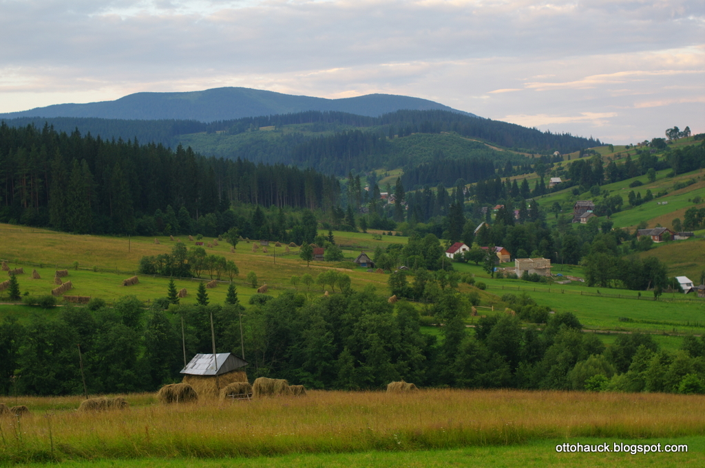
Typical haycocks in the Carpathian Mountains.

The tributary of theTereblja River.

Oborohs, the typical haylofts of the East Carpathian Mountains.

The oboroh, the typical hayloft of the East Carpathian Mountains, with adjustable height of the roof.

The tributary of the the Tereblja River.

The cascade.

The Tereblja River.

The Tereblja River.

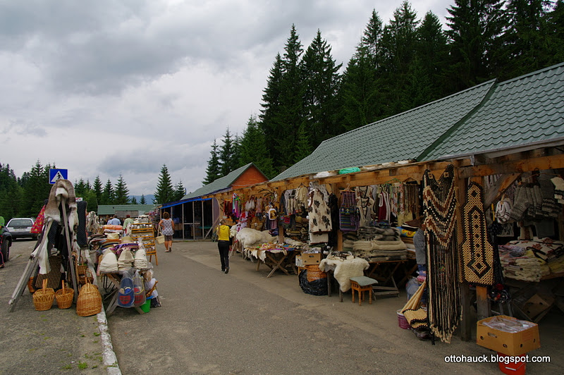
Information centre of Sinevir Natural Park, architecture typical for the area.

Cattle is still present on roads in the East Carpathian Mountains. The trafficc is not heavy yet on those roads.

Tereblja River above the village of Sinevir.

Cross at the margin of the village of Sinevir.

Victory lunch at Coliba restaurant. My sickness is over!

Coliba, the new resturant in Sinevir build in traditional style. It serves delicious local cuisine.

At the crossroad at Sinevir.

We tried to get a lift at Sinevir.

At bus terminal in Mezgorje. Nothing has changed here since 1993, when I was here for the first time.

Our last camp on the trip at Kchust. When we arrived here, the rain had not began yet.

The rain is approaching our location. I approaches us from across the Tisza River, close to romanian border.

Its raining already!

Day the 9th


The End